Fun fact! We don’t actually know that’s what the Pacific ocean looks like because we can’t get imaging deep enough to actually check. This model is simply assuming the ocean floor is there due to projections based on the bits we can get to. And I think that’s fun.
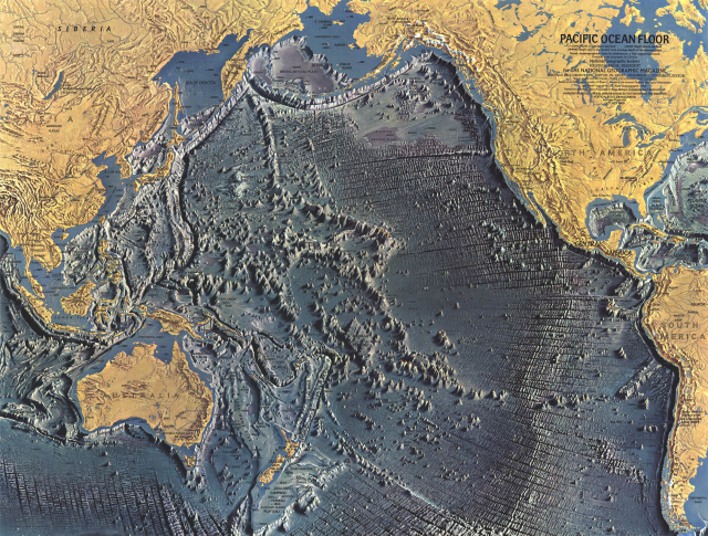
We’ve known what the floor of the pacific looks like for decades.
This is from a nat geo in 1969. We’ve done sonar imaging of the two deepest points in the Marianas Trench and sent multiple exploration vehicles into the trench. James Cameron has sent exploration vehicles into the marianas trench ffs. If we can explore the deepest trench in the pacific then we can get imaging of the rest of it.
Y’all really just get on tumblr dot com see a post and go “I think I will lie today.” don’t ya.
ALSO
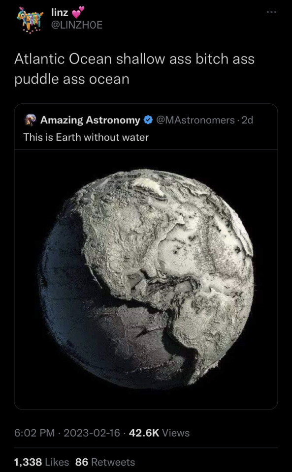
The original image?
That’s now what the Earth would look like without water.
That map up there has extreme vertical exaggeration added to it.
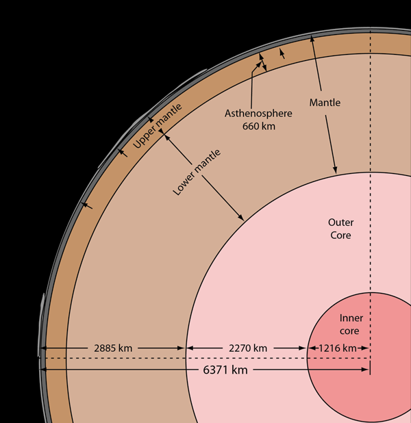
Now look at this diagram:
You see this? You see how smooth it is? You see how you can barely even see the continents?
Continental crust is upwards of 40km thick. You see the upper mantle/aesthenosphere? That’s 660km. You think 40km is gonna look like ANYTHING compared to that?
It doesn’t.
Yeah. The Earth is fucking big and continents and mountains are piddly and small compared to the diameter of the Earth.
Let’s put it this way, if the earth were shrunk to the size of a billiard ball, Mt. Everest would be 0.04mm high.